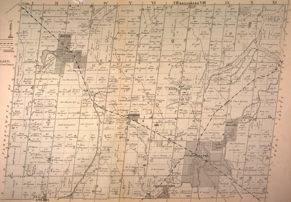
Esquesing Township Name
The township of Esquesing was surveyed in 1818 and opened to settlement the following year. Its name was said to come from a First Nations word meaning "the land of the tall pine(s)", but is more likely to come from the Mississauga word ishkwessin, meaning "that which lies at the end", which was the original name for Bronte Creek. The grid pattern of lines and sideroads that define the landscape of the township to this day, is often interrupted by the rugged cliffs of the Niagara Escarpment, the deep Credit River valley or the headwaters of Sixteen Mile Creek. It was this natural beauty that drew the Hurons first and then the Mississaugas to hunt, fish and live in this area.
The Township was organized into a municipality, and its council held its meetings at Stewarttown. The oldest village in the township was Stewarttown which could not compete with Georgetown after the railway was built. The principal road to Lake Ontario was Trafalgar Road so development of several settlements began along this route first. A more direct route to York was established by the York to Guelph Road, now Higway 7. In that era, these hamlets provided the essential services for pioneers and travellers. It was the arrival of the Railway in 1856 that changed the landscape and provided the stimulus for the urban development of Georgetown and Acton.
Map is Circa - 1877